
Understanding Drone LiDAR Technology
Drone LiDAR technology has revolutionized how we capture and analyze spatial data, providing high-resolution topographical information with remarkable efficiency. By integrating laser scanning with drone technology, surveyors, environmentalists, and engineers can gather data in a fraction of the time compared to traditional methods. The allure of this cutting-edge technology lies not only in its speed but also in its accuracy, making it indispensable for various applications such as mapping, construction, and environmental studies. When exploring options, drone LiDAR provides comprehensive insights into these systems and their capabilities, addressing the growing demands of modern industries.
What is Drone LiDAR?
LiDAR, or Light Detection and Ranging, is a remote sensing method that uses light in the form of a pulsed laser to measure variable distances to the Earth. When mounted on drones, LiDAR sensors can quickly collect data from large areas, generating detailed three-dimensional maps and models. Unlike traditional survey methods that are time-consuming and labor-intensive, drone LiDAR can penetrate vegetation and capture data in dense landscapes, making it effective for various sectors, including forestry, agriculture, and urban planning.
How Drone LiDAR Works
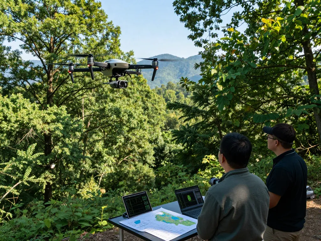
The operation of drone LiDAR involves several key components: the drone itself, the LiDAR sensor, and often a GPS and IMU (Inertial Measurement Unit) to ensure accurate positioning. The drone ascends to a predetermined altitude, and the LiDAR sensor emits rapid laser pulses toward the ground. As these pulses hit various surfaces, they bounce back to the sensor. The time it takes for the pulses to return is measured, allowing the system to calculate distances and create a precise topographical map of the surface. This data is then processed to produce point clouds, which can be transformed into 3D models and digital elevation maps.
Key Applications of Drone LiDAR
Drone LiDAR technology has found a wide array of applications across different industries. Its primary uses include:
- Surveying: Utilized for land surveys, construction layouts, and infrastructure assessments due to its efficiency and precision.
- Environmental Monitoring: Helps in habitat mapping, wildlife tracking, and vegetation analysis.
- Mining: Assists in volumetric calculations and site monitoring, which is crucial for mining operations.
- Urban Planning: Provides vital data for city planners regarding terrain and existing structures, supporting future developments.
Choosing the Right Drone LiDAR System
Selecting the appropriate drone LiDAR system can be challenging given the variety of options available in the market. It’s essential to evaluate your specific needs and how each system aligns with those requirements.
Factors Influencing Drone LiDAR Prices
The cost of drone LiDAR systems can vary greatly depending on several factors, including the type of sensor, drone compatibility, range, and additional features. Basic systems may start around $10,000, while more advanced setups, particularly those equipped with higher-quality sensors, can exceed $100,000. Understanding these variables can help businesses make informed decisions about their equipment investments.
Comparing Different Systems and Features
When comparing different drone LiDAR systems, consider the following features:
- Point Density: Higher point density results in more detailed data; however, it requires greater storage and processing power.
- Accuracy: The sensor’s accuracy is crucial for applications that involve legal or regulatory compliance.
- Battery Life: Longer battery life allows for extended flight times, enabling larger areas to be surveyed.
- Data Processing Software: Some systems come with proprietary software that can significantly enhance data usability.
Top Brands in Drone LiDAR Technology
Several brands have emerged as leaders in the drone LiDAR space, offering various systems tailored to specific applications:
- DJI: Known for their versatile drones, DJI also offers LiDAR payloads that are easy to integrate with their UAVs.
- Riegl: A pioneer in LiDAR technology, Riegl provides high-precision LiDAR sensors for various applications.
- Velodyne: Specializes in real-time 3D LiDAR technology, often used in autonomous vehicle applications but also applicable in drones.
Cost Considerations for Drone LiDAR
Investing in drone LiDAR technology goes beyond the initial purchase price. It’s essential to consider all associated costs to get a clear picture of the financial commitment.
Typical Price Ranges for Drone LiDAR Systems
The price of drone LiDAR systems can range significantly based on the capabilities of the system. Entry-level systems may start around $20,000, while comprehensive solutions that include advanced sensors and data processing capabilities can easily exceed $150,000. Evaluating your specific needs and budget will determine the best investment.
Budgeting for Additional Equipment and Training
In addition to the cost of the drone LiDAR system, businesses should budget for ancillary expenses such as:
- Additional Sensors: Depending on the application, you may need to purchase additional sensors.
- Software Licenses: Data processing software can come with significant licensing fees.
- Training: Proper operation of a LiDAR system often requires specialized training, which can add to the overall cost.
Potential Savings and Return on Investment
Though the initial investment in drone LiDAR can be substantial, it often leads to significant cost savings in the long run, particularly in sectors like construction and environmental monitoring. The speed and accuracy of data collection reduce labor costs and decrease project timelines, resulting in a positive return on investment.
Real-World Applications of Drone LiDAR
The applicability of drone LiDAR technology is broad and continually expanding. Here, we explore some of its most impactful uses.
Case Studies in Environmental Monitoring
In a recent project focused on forest management, drone LiDAR was employed to assess tree heights and biomass. The data collected enabled more informed decisions related to timber harvesting and sustainability, demonstrating how LiDAR can enhance environmental stewardship.
Construction and Engineering Applications
Construction projects have benefited immensely from drone LiDAR. One notable case involved a large infrastructure project where LiDAR data was used to create detailed 3D models of the site. This facilitated better planning and coordination among different teams, significantly reducing the likelihood of errors during construction.
Wildlife and Habitat Mapping
Drone LiDAR has also been instrumental in wildlife conservation efforts. By providing detailed terrain maps, organizations can effectively monitor wildlife habitats and make informed decisions about conservation strategies. This application highlights the versatility of LiDAR technology beyond traditional surveying and mapping.
The Future of Drone LiDAR Technology
As we look toward the future, drone LiDAR technology is expected to evolve rapidly, driven by advancements in associated technologies and increased demand across various industries.
Emerging Trends for 2026 and Beyond
By 2026, emerging trends in drone LiDAR technology are likely to include increased automation, such as the use of AI for data processing and analysis, and enhanced integration with other technologies like GIS (Geographic Information Systems).
Challenges and Innovations in Drone LiDAR
Despite the advantages of drone LiDAR, challenges such as regulatory hurdles, data privacy concerns, and the need for skilled operators remain. Addressing these challenges will require ongoing innovation and collaboration within the industry.
Expert Predictions for Industry Growth
Experts predict that the drone LiDAR market will see substantial growth in the coming years. Factors driving this growth include increasing demand for aerial mapping, the need for efficient data collection in various sectors, and the rising importance of data-driven decision-making.
What types of projects benefit from drone LiDAR?
Drone LiDAR is particularly beneficial for projects that require high-precision topographical data, such as construction site surveys, environmental assessments, and urban planning initiatives.
How much training is needed to operate a drone LiDAR system?
Operating a drone LiDAR system typically requires specialized training to ensure that operators understand both the technical aspects of the equipment and the regulatory frameworks governing drone operations.
Can drone LiDAR be used in urban areas?
Yes, drone LiDAR can be effectively utilized in urban settings, although it may require adherence to stricter regulations and considerations regarding airspace and privacy.
What are the limitations of drone LiDAR technology?
While drone LiDAR is a powerful tool, there are limitations, including its reduced effectiveness in areas with heavy foliage and the potential for data inaccuracies caused by environmental factors.
How do I maintain a drone LiDAR system?
Regular maintenance of a drone LiDAR system involves routine checks of the drone’s hardware, software updates, and calibration of the LiDAR sensor to ensure the accuracy of data collection.